Download

AIP LSGS
LOW PERFORMANCE SID RNAV and HIGH PERFORMANCE SID RNAV
HIGH PERFORMANCE SID RNAV only RWY 25:
This departure is only valid for pilots holding a type B qualification or holding an A qualification under certain weather conditions. For pilot holding a type A qualification the HIGH PERFORMANCE can only be used during day time.
LOW PERFORMANCE SID RNAV, Day only :
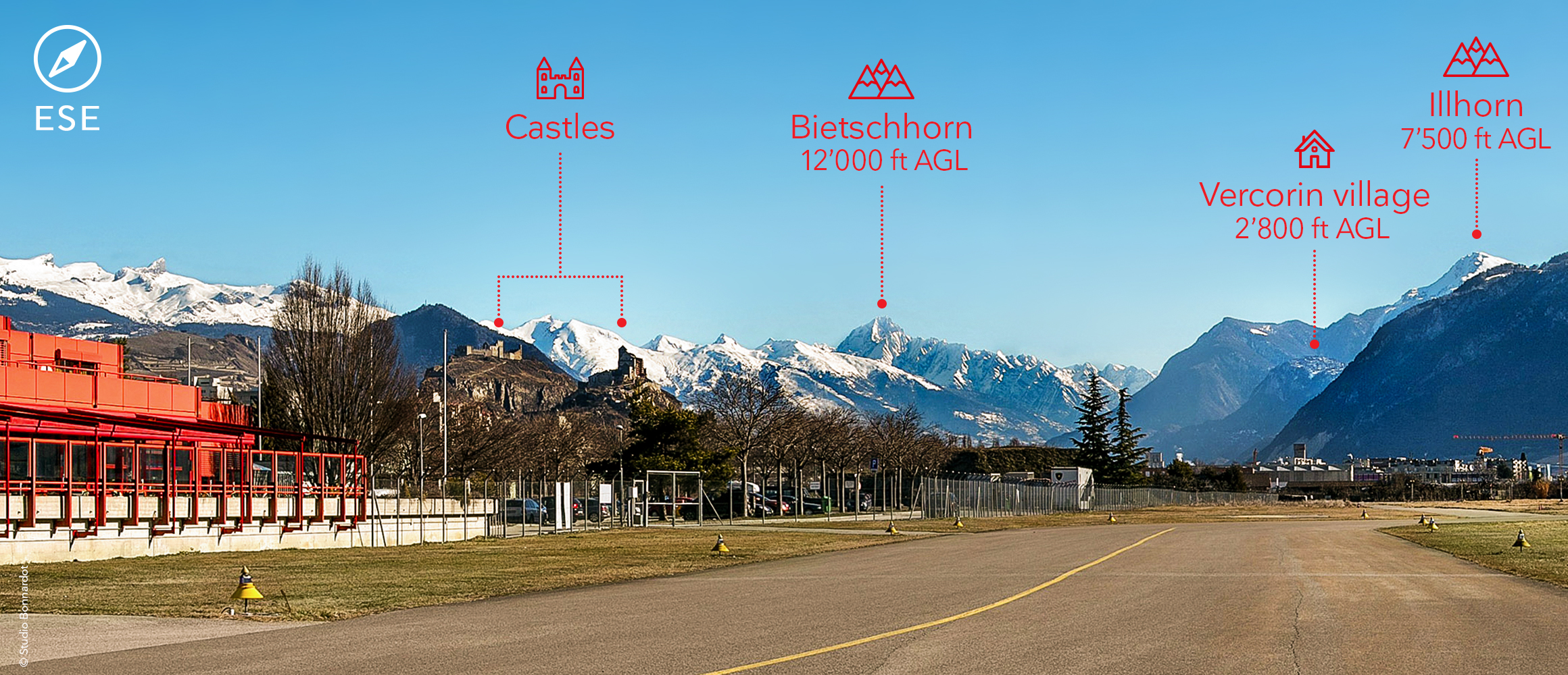
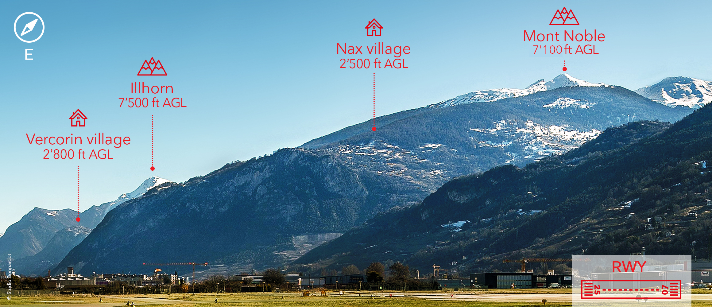
This departure is made up of a VFR segment whose route is recommended (see chart: LOW PERFORMANCE SID RWY 07/25 – RNAV). It is recommended that you turn off before the village of Vercorin to reach the GS300 waypoint.
When a LOW PERFORMANCE SID RNAV is performed, a pilot may request from ATC an early left turn to the west if he does not intend to fly to the village of Vercorin and GS300. After approval, ATC will inform the pilot that IFR will start at GS301 (1 NM west of LSGS). It is the pilot’s responsibility to comply with the climb gradient and minimum altitude constraints.
Operations at night
For operation at night, the following conditions need to be fulfilled:
IFR Arrival
- RWY 25 must be in use
- DA according to aircraft category
- Visibility 5 Km or more
- The pilot must hold a Qualification type B
- ACFT shall be able to fly the missed approach procedure.
IFR Departure
- RWY 25 must be in use
- Visibility 550 RVR
- HIGH PERFORMANCE SID RNAV only
- The pilot must hold a Qualification type B
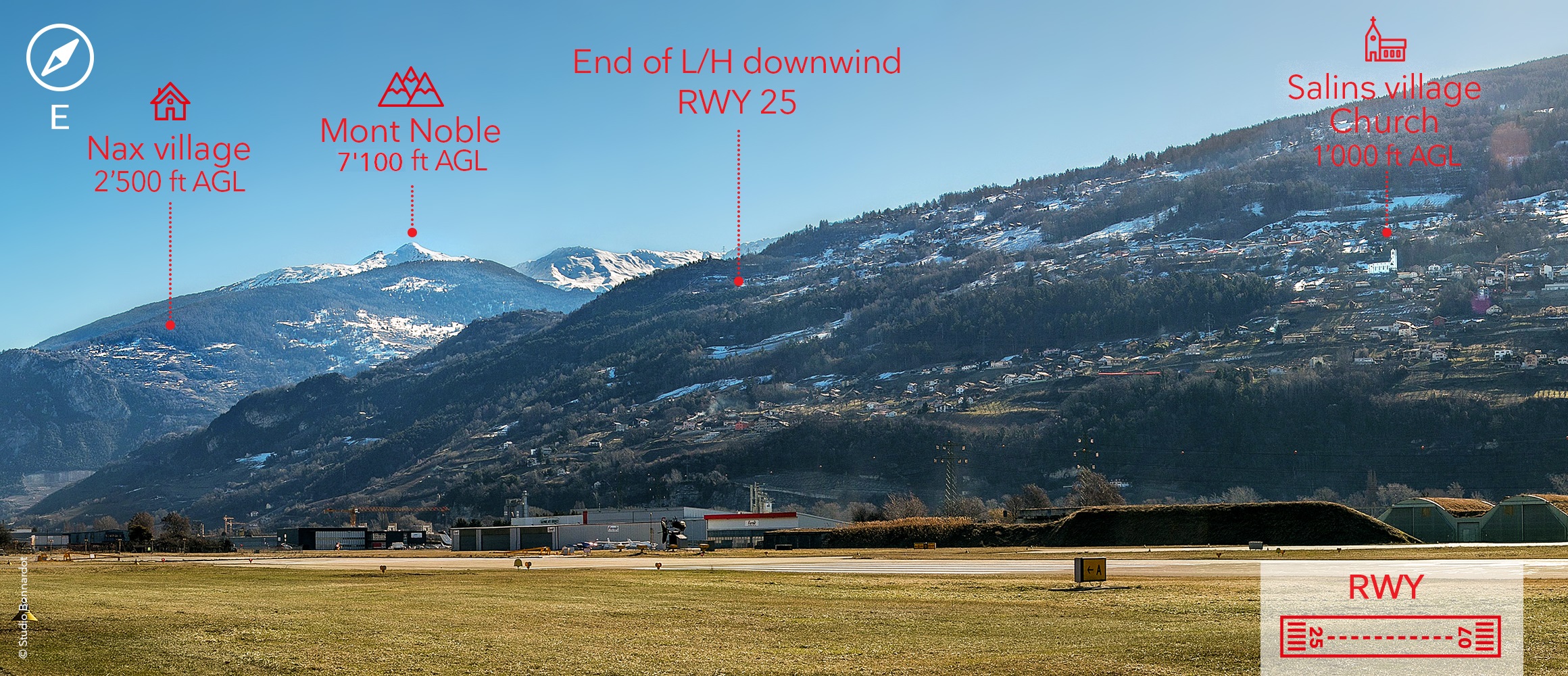
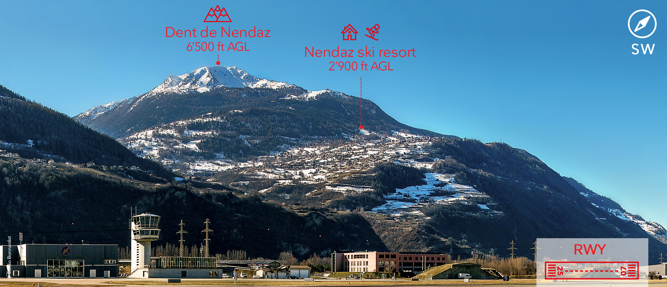
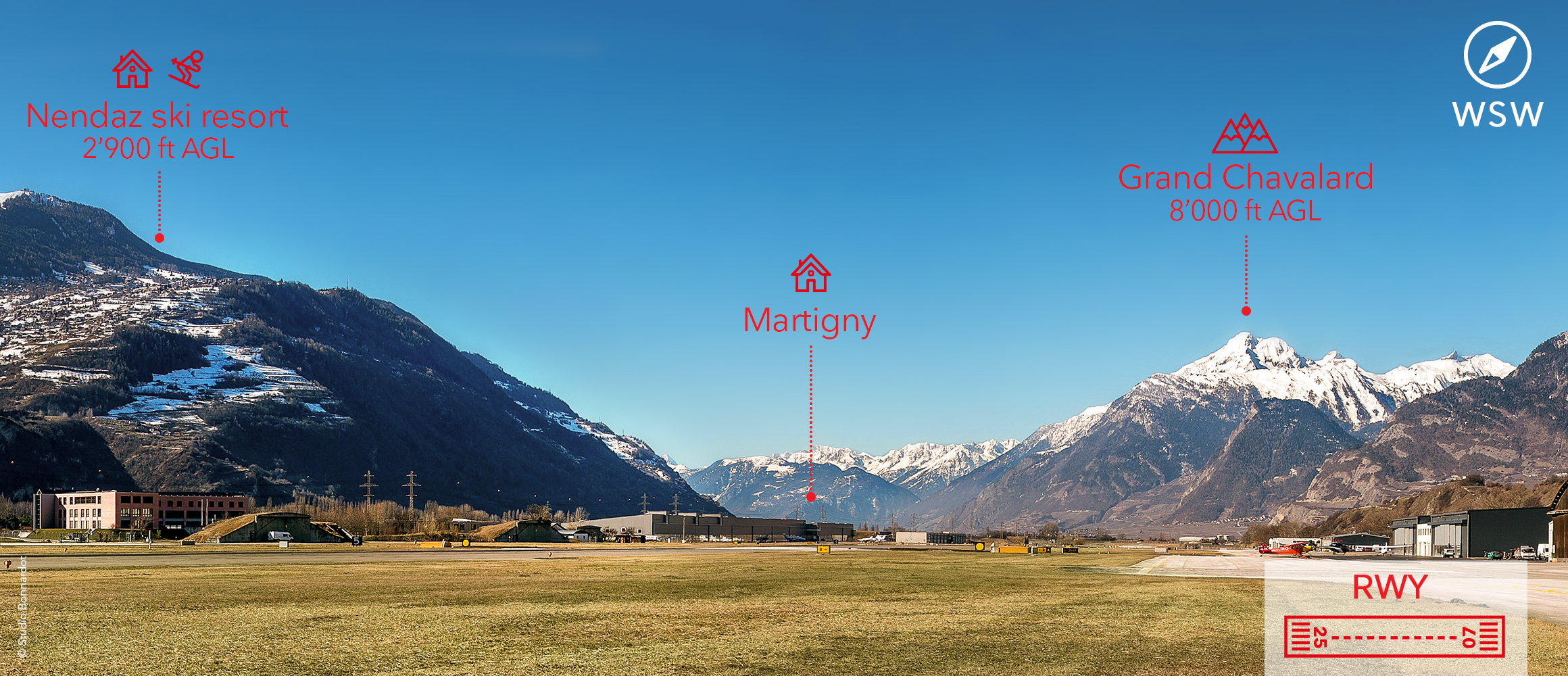
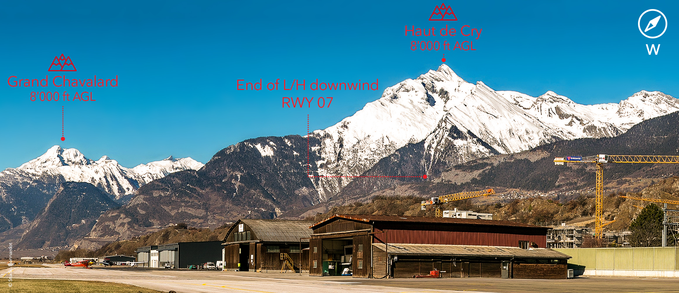
Visual approaches
Visual approaches need a clearance from ATC. During the period between March 1st and October 31st, glider sectors are active around the area of LSGS below FL150. As IFR flights are prohibited in these areas, ATC will monitor and instruct aircraft to remain clear of these sectors located north and south of the approach and departure routes. As a general guideline, it can be said that the best trajectory for visual approaches is along the IGS path and the SID track.
Download
Flight planning guide
Military activity
Airspace around LSGS above FL130 is used by the Swiss Airforce as a training sector and is classified as TRA (temporary reserved area). Military activity inside this TRA generally takes place from Monday to Friday, from 08:30 LT to 12:00 LT and from 13:30 LT to 17:00 LT.
Arrival and departure procedures are impacted by this activity because all IFR procedures cross this training sector due to terrain constraints.
Impact on IFR departure
All SID’s are designed with maximum altitudes to be respected to remain outside this military sectors. By default, pilots must comply with these restrictions according to the SID description. If these restrictions don’t need to be applied, ATC will spontaneously inform the pilot accordingly. During normal military operating hours, this information will be passed on during taxiing as this is a “last minute coordination” with military ATC.
Impact on IFR arrivals
As the IFR approach crosses the training sector, restrictions apply to IFR approaches to LSGS. The precise type and level of restrictions depend on the type of activity conducted within the Temporary Reserved Areas. Any delay for IFR approaches due to military activity is normally known already the day before operations as of 16:00 UTC (15:00 UTC during summertime period) but it is possible that a planned restriction is cancelled on short notice if the activity inside the TRA is modified.
Flight plans will be rejected during those periods when IFR approaches to LSGS are restricted.
There are 2 ways to avoid this flight planning restriction:
- Re-planning the arrival of the flight concerned before or after the relevant period
- If meteorological conditions permit, a rejection can also be avoided by cancelling the IFR part of the flight at specific nav points mentioned in the “flight planning guide”. Use this option with special care only, as flights unable to cancel IFR will need to divert or expect excessive holding time.
You will find all detailed information and guidelines in the annexed document “flight planning guide LSGS”.